The Ada County Assessor’s Office maintains comprehensive property records on all real and personal property within the county. This includes, parcel ownership, land and improvement characteristics, parcel boundaries, road rights-of-way, and the office also manages the addressing processes for all parcels within the county. Many property records and processes are maintained digitally and are available on this website, others are available by visiting our office between the hours of 8 am and 5pm Monday through Friday. Public terminals are available for the public to view and research property records.
Online Property Records & Maps
The Assessor’s Online Property Records page site was created in order to assist the public with locating information about property within Ada County. Along with comprehensive property records and search capabilities, our site also provides access to Records of Survey, Subdivision Plats, and Interactive Maps. Our online maps allow you to interact with our GIS data. Currently our maps include parcel boundaries, streets, hydrography, section boundaries, city limits, parks, and schools.
Online Documents
Access our online documents via the MaxView viewer, which is compatible and supported with newer versions of Microsoft Windows. All the projects that are available through Online Documents can be viewed using the MaxView software. To ensure the proper installation of the software, please take the time to read and follow the step-by-step installation instructions. You will also find a “MaxView Tips and Tricks” document that will be extremely helpful as you work with the software. To view the files below you will need to have the MaxView software installed on your computer. Once installed, to view the files, right-mouse-click on the document link below and select the “Save As a file” from the popup menu, then open the file using the MaxView application.
Public Property Tax System
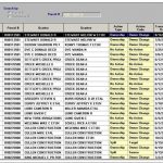
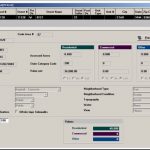
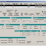
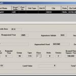
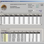
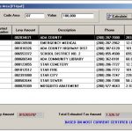
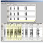
The Public Property Tax System provides real-time access to the Assessor’s database and public version of the Property Tax System. To see an example or use the public version of our Property Tax System, please come in to the Assessor’s Office. There are several computers available at our service counter for public use.
This includes:
Advanced search capabilities by
Parcel Characteristics View
Tax Value and History
Frequently Asked Questions
Ownership
How do I change my mailing address?
You can fill out a mailing address change request online. You can also get the form, and assistance filling it out, at the Assessor’s Office at 190 E Front Street, Suite 107 Boise, Idaho 83702. Please contact the Assessor’s Office with any questions at (208) 287-7200.
How do I find out who owns a parcel of land?
Primary owner information can be found on our Land Records property system website.
What information should appear on a recorded document to transfer my property?
We recommend you get a copy of your deed of acquisition from the Ada County Recorder’s Office, [email protected], and consult with an attorney before recording any property conveyances.
I have recently married, how do I change my name on the title of my property?
We do not accept a marriage license to change names in our records. The Assessor’s Office’s ownership records are based on recordings in the Ada County Recorder’s Office. To change your name in our records you would need to record a deed or an affidavit indicating the change. However, there is no requirement to do so.
If you decide you want to change your name in the record we recommend you get a copy of your deed of acquisition from the Ada County Recorder’s Office, [email protected] and then consult with an attorney before recording any property conveyances.
How do I add my spouse to the existing title of my property?
The most common way to add a spouse into ownership of your real property is to record a deed. We recommend you get a copy of your deed of acquisition from the Ada County Recorder’s Office, [email protected], and consult with an attorney before recording any property conveyances.
I am recently divorced, how do I remove my former spouse’s name from the title of my property?
Your divorce decree should state how the property is to be conveyed.
~ If the decree states that you were awarded the property, it may be possible to use the decree to remove the former spouse’s name from the property. It is always wise to consult your attorney if you have any questions concerning the decree.
~ The decree may state that you will need to record a deed to convey the property. Check with your attorney to see if a deed has been prepared for the transaction. Please remember that the Grantor on the new document must be exactly as it was when you acquired title to the property.
My spouse passed away, what do I need to do to update the ownership records?
If the deceased passed away without a will, the surviving spouse could record an affidavit in lieu of probate and the death certificate of the deceased. If there is a will in effect at the time of death, we recommend that you speak to an attorney.
There are types of ownerships that allow the removal a deceased spouse with the recording of a death certificate. For more information and assistance, you can contact our office at (208) 287-7262. You can also find more information on the Court Assistance web page, Ada County Court Assistance.
Property Records
How current is your property record data?
Changes made to the data and maps are updated nightly. However, it can be several business days before a recorded document is reflected in our online records.
Where can I obtain a legal description?
Legal descriptions are provided upon request. You can email us or visit the Land Records counter in the Assessor’s Office. If you want a copy of the recorded document, contact the Ada County Recorder’s Office.
Can your office help me with an easement question?
The Ada County Assessor’s office does not track easements, but we might be able to provide you with a copy of a plat or survey that shows the easement. If you need more detailed information, we suggest you contact a local title company.
Where can I get a copy of a subdivision plat or a survey?
You can get a copy from our online Property Info and Mapping. You also have the option of visiting the Land Records counter in the Assessor’s Office or contacting our office.
There is incorrect information on my assessment notice, how can I have it corrected?
If you feel there is an error on your notice, please contact your appraiser directly at the phone number listed on your assessment notice. More information on understanding your Assessment Notice.
Are owner names searchable on the property records website?
For privacy reasons, owner names are not searchable on the website. Primary owners for each parcel can be found on the parcel details on Property Search & Online Maps page of the website.
Why don’t my property boundaries match my fences on the Ada County mapping website?
The Assessor’s parcel map is created for assessment purposes only. The data that we incorporate into the map is compiled from recorded documents and that data can vary greatly in quality. The Assessor’s parcel map does NOT represent a professional survey and should not be used to accurately determine property boundaries or whether fence locations are correct.
Parcel Actions
How do I split, combine, or adjust my property boundaries?
You will need to contact the appropriate city Planning and Zoning Division or Ada County Development Services to determine the procedure you will need to follow. The Assessor’s Office requires that a new deed to be recorded with the new legal description for the parcel.
How do I get my property surveyed?
You will need to contact a licensed land surveyor. A list of local land surveyors can be found in the phone book. More information can be found on the website of the Idaho Society of Professional Land Surveyors.
I had a survey done and it was recorded. Do I still have to record a deed to adjust the property boundary to match the survey?
The recording of a survey does not convey ownership, change property boundaries or create new Assessor’s tax parcel numbers. A deed with the new metes and bounds or the narrative property description must be recorded for the Assessor’s Office to make any changes in ownership or create new tax parcels.
